 Hire Now
 Message Srihari
Want a profile like this one?
Join thousands of news professionals who use journalist.net to showcase their work and get hired by top media outlets.
Get started
See how it works
Connect through Journalist.net
1
Verified professionals
Every journalist on this platform has been manually verified by our London team. You're connecting with a confirmed news professional.2
Protected engagement
We safeguard journalist contact details and provide insurance coverage for all bookings. Both parties work with confidence and security.3
Secure payment
Payments are held in escrow and released when the work is delivered. Journalists are guaranteed payment; clients approve before funds are finalized.Still have questions?
Check FAQAbout Srihari
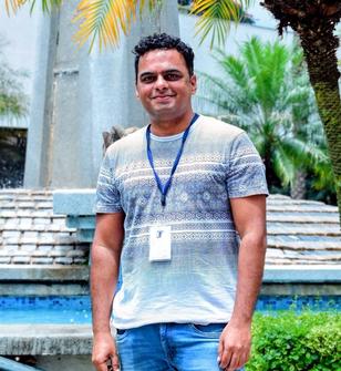
Srihari Karanth is a DGCA-certified drone pilot and visual journalist based in Bengaluru, known for capturing powerful aerial narratives across India. His journalism focuses on urban development, infrastructure, tourism, cultural heritage, festivals, and real estate transformation. He has documented metro expansions, expressways, tech parks, historic temples, and large-scale public gatherings through high-impact drone cinematography.

What makes his work distinctive is the combination of technical flying precision and storytelling vision. Srihari doesn’t just capture visuals from the sky - he presents scale, symmetry, and context that ground-level reporting often misses. His aerial coverage of Bengaluru’s tech corridors, emerging infrastructure, and heritage landmarks has reached millions, with features and shares from government and tourism bodies. His work blends journalism with cinematic clarity, offering audiences a fresh perspective on India’s growth and cultural depth.
Portfolio
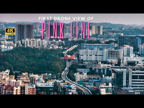
Bengaluru, Karnataka — In a first-of-its-kind aerial documentation, drone footage has captured the progress and trial runs of the Pink Line of Namma Metro, offering the public an uninterrupted view of this transformational urban transport corridor as it takes shape above the city’s busy streets.
The Pink Line, part of Bengaluru’s expanding metro network, will connect several major hubs — including JP Nagar, Jayadeva Hospital, IIM Bangalore, Hulimavu, and Tavarekere — spanning a critical stretch that eases long commutes across south and central Bengaluru.
Drone shots showcase the elevated tracks threading through dense traffic corridors, revealing the scale of infrastructure and how the alignment interacts with the urban fabric below. These aerial visuals, shot during trial runs with peak-hour road traffic visible beneath, give citizens a unique birds-eye perspective on both construction and the line in motion.
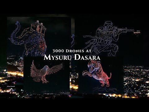
On 28 September 2025, a coordinated swarm of 2,983 drones took to the night sky to form a giant tiger, India’s national animal in a landmark achievement for aerial storytelling. The formation officially secured the record for the “Largest aerial image of a mammal formed by multirotor drones,” surpassing the previous benchmark of 1,985 drones!
Organized by the Chamundeshwari Electricity Supply Corporation (CESC) Mysore and executed by Indian drone technology pioneers BotLab Dynamics, the show was part of a four-night series of drone light performances during the 10-day festival. Thousands of spectators gathered in person, and millions more worldwide watched viral footage shared across social media platforms.
Deviramma Betta, located near Chikkamagalur, is home to the sacred Deviramma Temple, which opens only once a year during Deepavali.
Lakhs of devotees trek 7.5 km uphill (and 7.5 km back) barefoot to seek the goddess’s blessings.
The drone footage, filmed during the early morning hours of the festival, captures thousands of pilgrims ascending the hill under mist-covered skies. From above, the rush of devotees contrasted beautifully against the dark slopes, offering a rare perspective of faith, endurance, and celebration merging into one powerful visual.